A landslide happens in a mining town, covering several houses under cubic tonnes of rubble. With virtually no trace of where the houses used to stand, how can disaster responders efficiently target their search for those buried structures?
On the morning of September 20, 2018, a portion of a mountain in Naga City, Cebu collapsed, covering at least 46 houses and trapping dozens of residents under the rubble. Rescue operations had to be carefully executed, as the rains in the area loosened the soil in the barangays of Tinaan and Naalad. Moreover, heavy equipment couldn’t be used extensively, and disaster responders had to tread the perilous landscape with caution.
Several groups from different parts of the Philippines mobilized to respond to the needs of the town at ‘Ground Zero’ and provide important spatial information to the rescuers on the ground. The DATOS Team of the DOST-Advanced Science and Technology Institute was one of them.
The rescuers faced a particularly challenging problem, though. With markers for the houses in the area like trees and structures gone, how could the rescuers target their search efforts efficiently?
A data-driven approach to disaster response
The first thing the DATOS researchers did was figure out where exactly the landslide occurred.
A huge amount of information appeared on social networking sites mere hours after the landslide event. The team cross-referenced social media images, news reports, and aerial videos with available satellite imagery for preliminary assessment of the area.
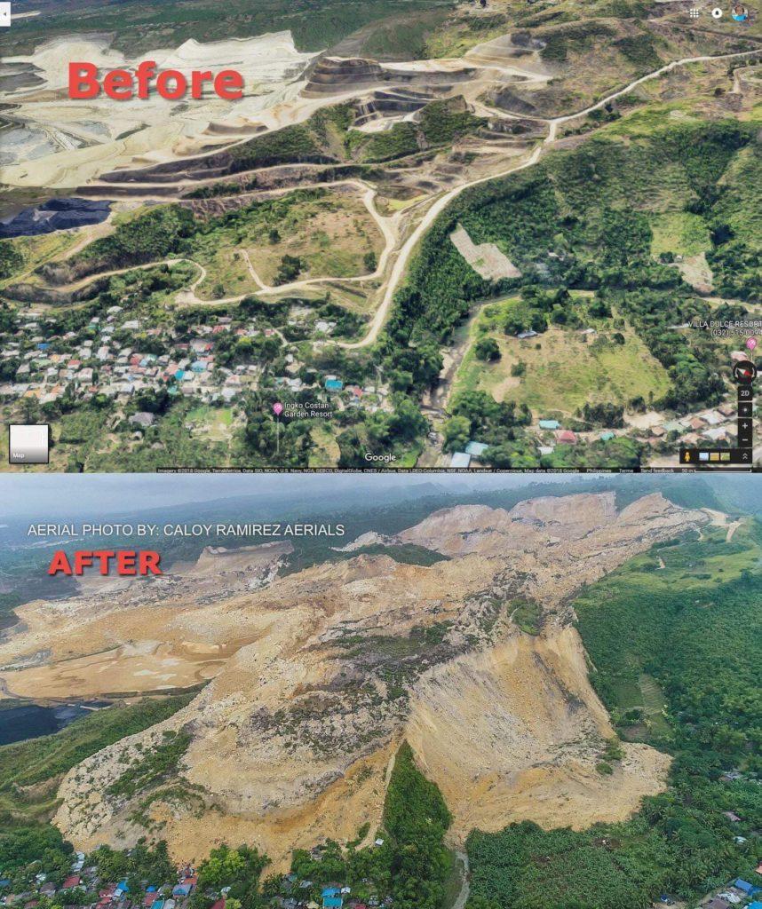
An example of aerial photos posted on social media used for cross-referencing satellite images. The team used this information for determining the exact location of buried houses. (Credit: DATOS/DOST-ASTI)
After identifying the specific location in Naga, the team marked the affected houses using the archived images on hand. At that point, there weren’t any satellite images yet of the area after the landslide. Thus, the team relied on Google Earth to delineate the extent of the landslide.
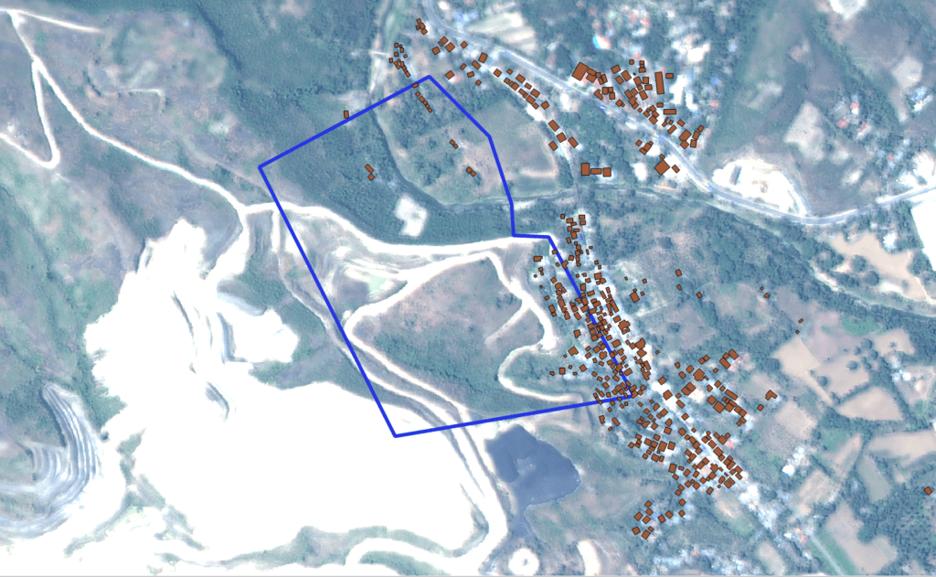
Satellite Image of Barangays Tinaan and Naalad, Naga, Cebu. The blue line is the rough delineation of the landslide area based on photos and videos from social media. The team used Google Earth satellite imagery to delineate the area and identify the houses and their corresponding coordinates. Meanwhile, actual building footprints were provided using orthophotos by UP CENVI. (Credit: DATOS/DOST-ASTI)
Mapping the scene
The team extracted the coordinates of the houses, plotting them out on a map. These coordinates, which can be plugged in any GPS device, were forwarded to the provincial and local government units and the Office of Civil Defense.
The map and coordinates were also forwarded to some of the DATOS team’s colleagues in UP Cebu. Researchers from the Central Visayas Center for Environmental Informatics – CENVI (CENVI) and FireCheck projects used their expertise and existing LiDAR data to improve on these maps. They identified additional houses that they had previously not seen using the satellite images. Upon acquisition of an updated post-landslide Planet satellite image (on 21 September 2018), the team updated the coordinates of the affected houses accordingly.
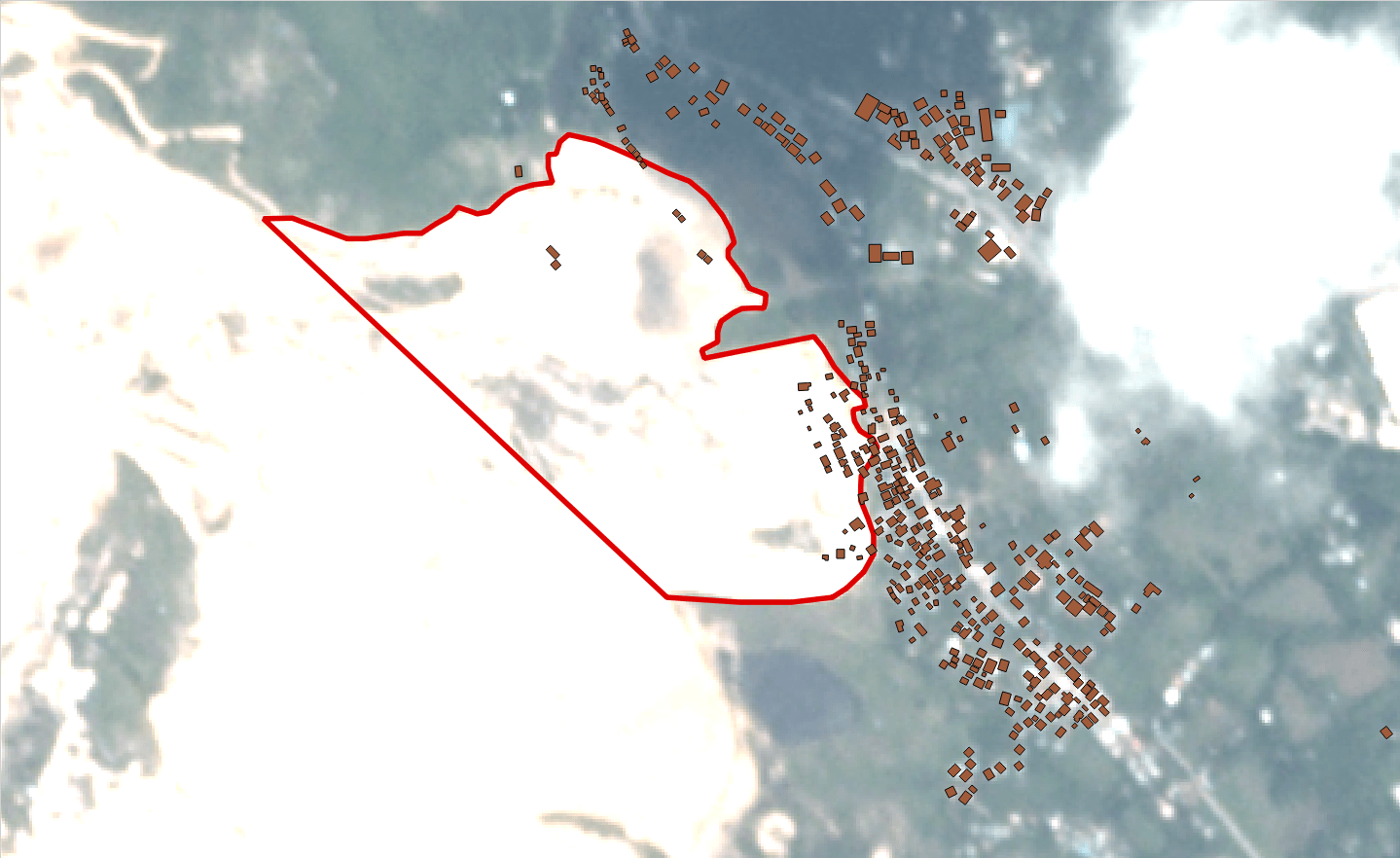
Satellite Image of Barangays Tinaan and Naalad, Naga, Cebu captured after the landslide event. The red line is the updated actual delineation of the landslide area. (Credit: DATOS/DOST-ASTI)
On the ground
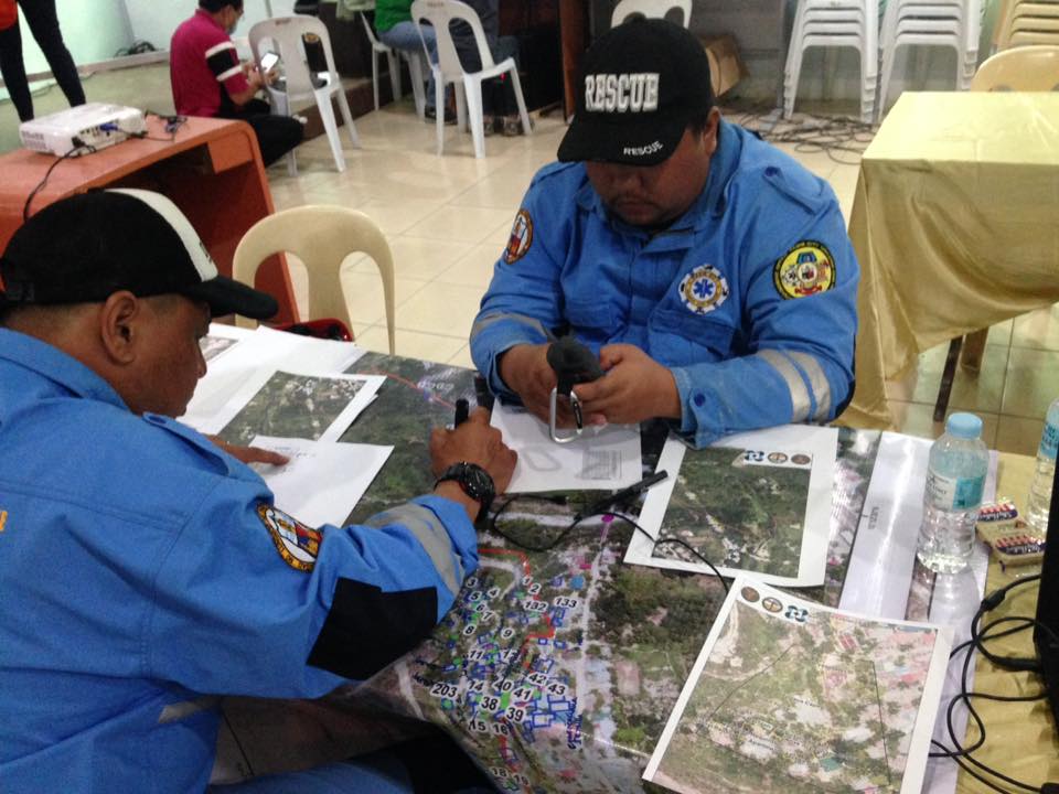
Volunteers from CENVI and FireCheck printed the maps and delivered them to the Naga City rescue command post. They also divided the map into smaller maps, with specific areas of response.
The disaster responders used coordinates and maps based on reports from the ground in marking the covered houses. This enabled the team to quickly identify priority areas for search and rescue.
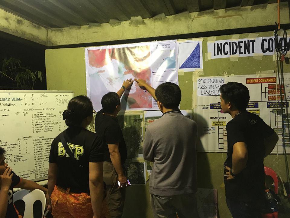
Responders analyzing the map at the Ground Zero command post. (Credit: DATOS/DOST-ASTI)
Responders on the ground using the map with the updated landslide delineation from DATOS, divided into specific areas of response by UP-CENVI. (Credit: DATOS/DOST-ASTI)
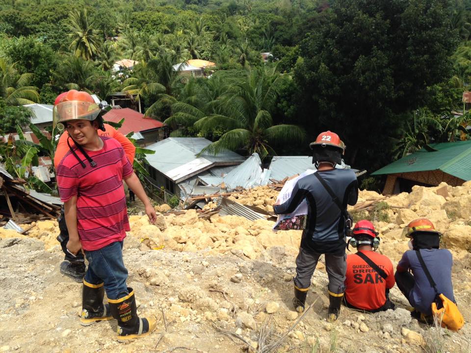
UP CENVI/FireCheck projects assisting Pasig and QC rescue teams and OCD to locate buried houses, victims. The rescuers used life sensors, void detectors, and fiber optic cameras to find signs of life beneath the rubble. (Credit: DATOS/DOST-ASTI)
Satellite imagery and Geographic Information System (GIS) maps can provide a wealth of information for disaster assessment and risk evaluation. In this situation, by effectively utilizing social media images to locate and delineate landslide extents, rescuers were able to save lives. This proves that using spatial technology need not be highly technical nor under ideal circumstances. To paraphrase an old saying: It’s not just about the tools — it’s about how you use them. -MF
Cover photo: Denniz Futalan/Pexels

Author: Jo Brianne Briones
Jo handles information, communications, and PR duties for DOST-ASTI’s DATOS project. Besides having worked extensively in disaster research and information dissemination for science agencies, Jo produces tech review videos and makes science more accessible to the general public through online news and feature articles.