•In 2018, Central Visayas sustained over a billion pesos’ worth of damage due to fire incidents.
•The FireCheck project is an initiative to create fire hazard maps and 3D models of the region’s fire-prone areas.
•Experts and government agencies are working together on the project, which will be completed in 2020.
The Bureau of Fire Protection (BFP) recorded 1,011 fire incidents in the Central Visayas region from January to November of last year. Compared to 622 incidents over the same time period in 2017, there was a 62 percent increase in fire incidents, resulting in approximately PHP 1.1 billion in damage. 550 of those incidents (and PHP 1.05 billion of the cost) were from Cebu City alone.
Thus, a new proactive initiative funded by the Department of Science and Technology – Philippine Council for Industry, Energy and Emerging Technology Research and Development (DOST-PCIEERD) aims to solve this worsening problem.
The FireCheck project
FireCheck is a fire hazard mapping and spread modeling project developed by experts in Cebu. It uses data to enhance the region’s fire response, prevention, disaster assessment, and risk evaluation. It is handled by the University of the Philippines (UP) Cebu, in partnership with the Cebu City Disaster Risk Reduction Management Office (CCDRRMO).

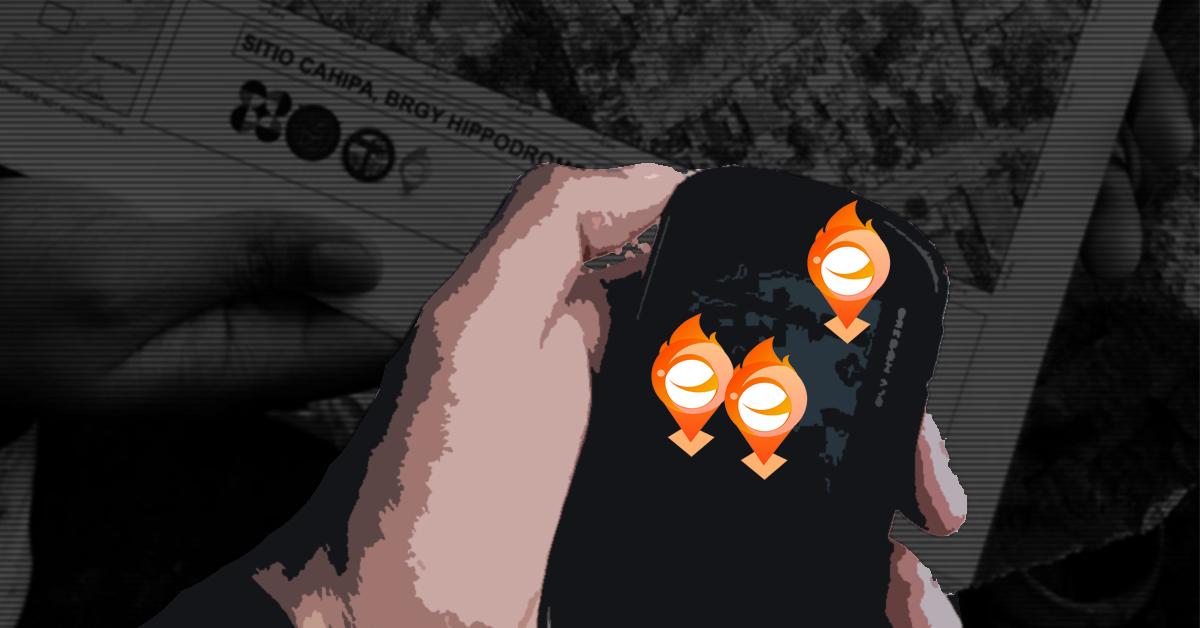
Mapping out fire hazards to preemptively stop fires. (Image: FireCheck Facebook page)
“Fire hazard mapping is a vital step in acknowledging fire as an inevitable disaster that must be accommodated similarly to how we prepare for disasters,” said Prof. Aileen Joan Vicente, who leads the Firecheck project.
According to Vicente, Firecheck’s hazard maps identify highly populated, fire-prone residential areas in cities based on building density, the types of construction materials used, and whether or not they are urban heat islands. Urban heat islands are urban areas that are significantly warmer than the rural areas around them.
Flame game
At present, Vicente’s team is verifying the fire hazard maps for three cities: Cebu, Mandaue, and Lapu-Lapu. They are working alongside the CCDRRMO, the City Planning and Development Office, and BFP Regional Office 7.
The team also created 3D maps of high-risk communities, fire spread simulations, models, and an app. The FireCheck Attribution App displays the maps, with useful information for developing fire response strategies. It was tested in Barangay Basak in Lapu-Lapu last January 28, and is currently being refined.
“Through the FireCheck project, we will know the direction of the flames when there is fire,” explained CCDRRMO chief Nagiel Bañacia. “After the firefighting, we will also know how many and who are the victims of the fire because those details will be in the Firecheck Project already.”
“With Firecheck, we can provide a smart solution in increasing the community’s resiliency against fire disaster,” said Dr. Enrico C. Paringit, DOST-PCIEERD’s Executive Director.
Vicente believes that a “scientific and proactive approach to fire disasters” should be adopted not just in Cebu, but across the Philippines as well.
The team aims to complete the FireCheck project in 2020.
Cover photo:
References
- Official press release from PCIEERD
- https://cebudailynews.inquirer.net/219318/firecheck-project-uses-technology-in-disaster-mitigation-and-response
- https://www.sunstar.com.ph/article/1781128

Author: Mikael Angelo Francisco
Bitten by the science writing bug, Mikael has years of writing and editorial experience under his belt. As the editor-in-chief of FlipScience, Mikael has sworn to help make science more fun and interesting for geeky readers and casual audiences alike.